 English
  French
  Spanish
  Chinese
  Japanese
  Korean
  Hindi
Hindi  German
  Norwegian
  Italian
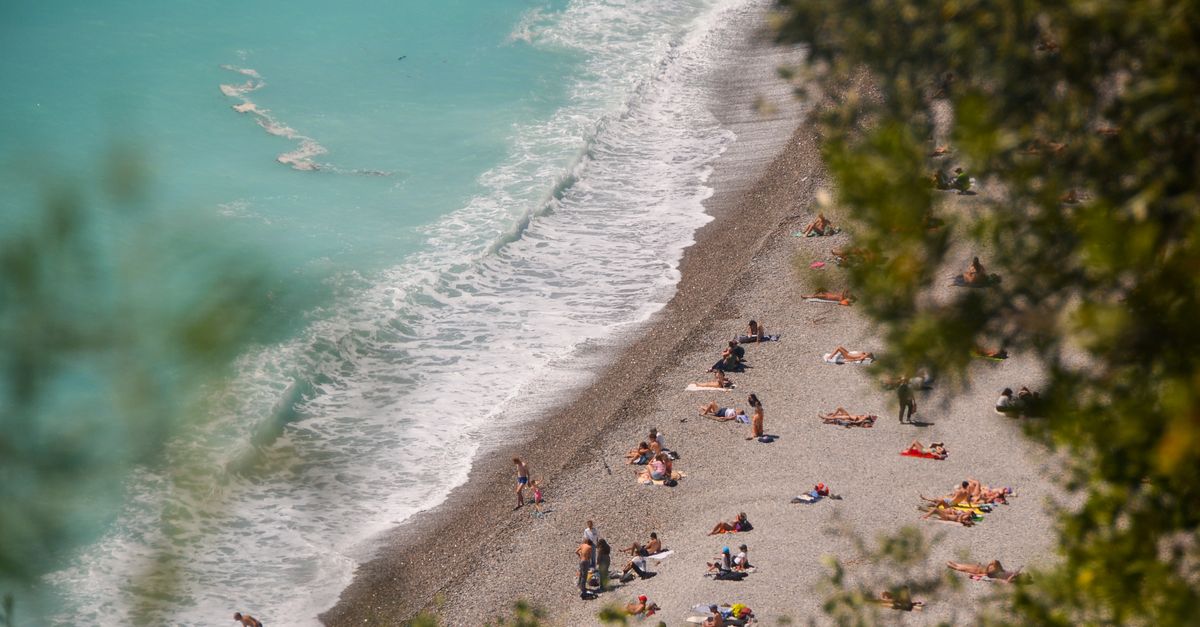
Heatwave June 27, 2026: red alert and imminent thunderstorms
This Saturday, June 27, 2026, the historic heatwave that has hit France since June 16 reaches its peak. Météo-France keeps 37 departments under red alert and 48 under orange alert. Tens of millions of French people face heat never seen at this time of year, while violent evening thunderstorms are expected to gradually end the episode.
Absolute records shattered
The June 2026 heatwave is no ordinary hot spell. June 24, 2026 officially became the hottest day ever recorded in France, with a national 24-hour average of 29.9 °C, beating the 29.4 °C records from July 2019 and August 2003.
Locally, thermometers reached unprecedented June levels. Saumur, in Maine-et-Loire, recorded 44.1 °C on June 23, while Pissos in the Landes reached 44.3 °C. The national maximum thermal indicator reached 38.2 °C, above the 37.7 °C measured during the terrible 2003 heatwave.
Météo-France describes this episode as one of exceptional severity, comparable to or worse than August 2003, which caused nearly 15,000 deaths in France. On June 25, up to 72 departments were simultaneously placed under red alert, an absolute record in French weather vigilance history.
An alarming health toll
The human consequences of this heatwave are dramatic. Since the beginning of the hot spell on June 18, the Interior Ministry had counted 74 drowning deaths across France, a brutal rise linked to people trying to cool off in unsupervised water areas.
In Paris, Samu emergency services recorded 109 deaths in a single Friday, compared with the usual average of 7 at the same time of year. The figure alone shows the devastating impact of extreme heat on fragile populations.
In Hauts-de-France, a provisional report on June 24 listed 4 deaths directly linked to heat and 161 emergency-room visits related to hyperthermia. Santé publique France says the final excess mortality toll will only be known in several months.
Violent thunderstorms expected tonight
The good news this Saturday, June 27: significant thunderstorms are forecast for the evening. A first storm wave swept through Hauts-de-France in the morning, and a more active second one should move from Pays de la Loire toward Normandy, Île-de-France and Champagne-Ardenne.
These storms may be intense and locally dangerous: hail, wind gusts above 80 to 100 km/h and torrential rain are expected. An orange thunderstorm alert has been issued for Paris and Île-de-France, and the following temperature drop should be spectacular.
Even if relief is near, caution is essential: a violent storm after several days of extreme heat brings its own dangers, including slippery roads and flash-flood risks. Go indoors before storms arrive and avoid isolated trees and flood-prone areas.
How to protect yourself during the final hours of the heatwave
Although the end is approaching, June 27 remains extremely dangerous in areas still under red alert. Essential steps are:
- Stay indoors during the hottest hours (11 a.m.-8 p.m.) in a room protected from the sun.
- Hydrate regularly, without waiting to feel thirsty — at least 1.5 liters of water per hour of outdoor activity.
- Avoid intense physical effort during the day. Sport is discouraged until conditions return to normal.
- Check on isolated people — elderly neighbors and vulnerable relatives — and report worrying cases to 15 or 3114.
- Never leave a child or animal alone in a vehicle, even for a few minutes: temperatures can exceed 60 °C in less than 15 minutes.
A climate turning point that raises questions
Beyond the immediate emergency, this June 2026 heatwave reopens the debate on France’s adaptation to climate change. Compared with 2003, it comes earlier in the season and shows thermal anomalies up to 20 °C above normal in western France.
Public authorities, local governments and health professionals are mobilized. The national heatwave plan has improved warnings since 2003, but resources remain strained and adapting cities, homes and infrastructure is now an absolute priority.
For now, on Saturday, June 27, the priority is the same for every French person in alert zones: protect yourself, protect others and wait for the evening storms to bring relief.