 French
  German
  English
  Spanish
  Hindi
Hindi  Italian
  Japanese
  Korean
  Norwegian
  Chinese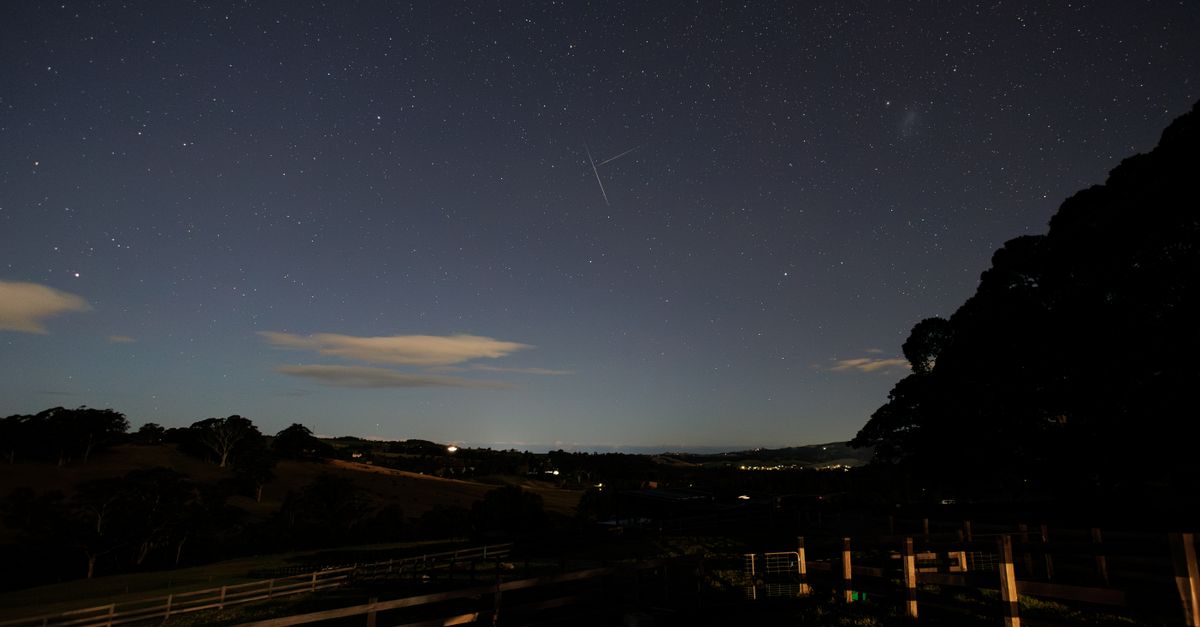
Light pollution: how many satellites have changed our nights?
Light pollution no longer comes only from streetlights, shop windows and urbanized areas. Since 2019, a second layer has been added above our heads: satellites in low Earth orbit, with Starlink now forming the most visible and numerous fleet. For amateur observers, the change is therefore no longer simply about finding a dark place on the ground: they also have to deal with what crosses the sky.
When we talk about light pollution, the figures immediately show the scale of the shift. Before the first Starlink launches, there were about 2,200 active satellites in 2019. In 2026, Orbital Radar counts more than 18,000 satellites in orbit. And as of September 6, 2026, azmth tracking alone shows 11,088 Starlink satellites. In other words, the current Starlink constellation by itself represents about five times the total number of active satellites recorded in 2019, even though the two counts are not based on exactly the same definition.
From 2,200 satellites to more than 18,000: what has really changed
The break is recent. Starlink began launching in 2019, and its satellites operate mainly in low Earth orbit, at around 550 km altitude. They become visible when they reflect sunlight. The famous freshly deployed “trains” are particularly bright, but this highly spectacular effect lasts only a few days after launch; satellites in their operational phase are significantly dimmer.
Can we therefore answer the question precisely: “How many satellites cross the sky above France each night?” No, not with one serious figure. The available data provide the size of fleets in orbit, not a national number of visible passes per night. Visibility depends on the exact location, the time, the geometry between the Sun, the satellite and the observer, and the deployment stage of the spacecraft. Likewise, there is no comparable series here for France between 2016 and 2026. Giving a figure such as “ten years ago versus today” would therefore manufacture a level of precision that does not exist.
On the other hand, the orbital order of magnitude is unambiguous: from about 2,200 active satellites in 2019 to more than 18,000 satellites in orbit today, with a projection that could reach 30,000 satellites by 2030. For anyone who photographs the sky or observes the same area for a long time, this mechanically means more opportunities to see an artificial trail appear.
France: 85% of the country already heavily affected by ground-based light
Even before adding satellites, the French sky was already far from uniformly dark. In 2020, the French National Biodiversity Observatory estimated that 85% of mainland France was exposed to a high to very high level of light pollution in the middle of the night.
To compare locations, the most useful indicator is zenith luminance, expressed in mag/arcsec², which is used by the National Biodiversity Observatory's mapping under reference conditions: middle of the night, clear sky and no Moon. ANPCEN complements this approach with field measurements carried out for more than fifteen years at many points across the country.
However, caution is needed with rankings such as “the ten French cities with the most polluted skies.” The data available here do not provide a quantified city-by-city ranking, nor a named loss of stellar magnitude by region. It would therefore be misleading to claim that a particular city loses a certain number of magnitudes or that another is officially the best in France.
The right map is not the one that promises a spectacular ranking, but the one that lets you compare the same indicator, under the same conditions, between several precise points.
The most reliable method for comparing two cities or two regions
- Open a light pollution map from the ONB, ANPCEN or a tool such as lightpollutionmap.app.
- Locate your home, then several accessible areas around it.
- Compare zenith luminance values rather than simply the color of the map.
- Choose a point that is clearly darker than your usual location, without necessarily looking for a “perfect” site.
- For a fair comparison, keep the same conditions: clear sky, no Moon and the middle of the night.
This method does not produce a pointless national podium, but it answers an observer's real question: “Where should I go tonight to genuinely improve the quality of the sky?”
How to find a darker sky near you
An individual obviously cannot act on the thousands of satellites already in orbit. However, they can greatly reduce the disturbance they experience by choosing the place and time of observation more carefully.
1. Start with terrestrial light pollution
The first step is to leave the brightest accessible area. Using an ONB, ANPCEN or lightpollutionmap.app map makes it possible to identify areas where sky luminance is lower. The goal is not necessarily to travel hundreds of kilometers: sometimes the useful gain simply comes from moving from a very brightly lit area to a less exposed one.
2. Then check satellite passes
Before an observing or astrophotography session, services such as Find Starlink and Heavens-Above can predict passes based on the user's geographic location. azmth makes it possible to track the Starlink fleet live, with CelesTrak data updated every two hours.
This check becomes particularly useful when a Starlink train has just been launched, because those satellites are then much brighter for a few days. Once integrated into their operational orbit, they remain present but are less dazzling.
3. Observe under the same conditions as the maps
To judge whether one site is really better than another, avoid comparing a moonlit evening with a moonless one. The ONB reference maps use a clear, moonless sky in the middle of the night. Reproducing these conditions as closely as possible makes the comparison much more meaningful.
The real change: observing becomes planning
Just a few years ago, looking for a dark sky mainly meant moving away from urban glows. In 2026, that reflex is no longer enough: a sky that is dark from the ground can still be crossed by artificial objects in low Earth orbit.
This is probably the most concrete change for amateurs. The problem is not that a satellite is visible from time to time, which is an old phenomenon, but that orbital density now requires an observing session to be thought of in two layers: light produced on the ground and bright trajectories in the sky.
This development explains why preserving the night sky is on the agenda of the International Space Summit being held in Paris on September 9 and 10, 2026. France already regulates artificial light emissions on the ground through the Environmental Code and a 2022 decree on outdoor lighting. But light congestion coming from orbit raises a different issue, one that cannot simply be solved by switching off a streetlight.
The figure to remember is therefore twofold: 85% of mainland France was already heavily to very heavily affected by terrestrial light pollution in 2020, while the number of objects in orbit has exploded in just a few years. To find a truly worthwhile sky again, the best approach is now very practical: first a light pollution map, then satellite-pass tracking, and finally observation under comparable conditions.